It’s fascinating how technology allows us to explore into the past and explore the evolution of land ownership and boundaries over time. ESRI Historic Maps provide a unique opportunity to analyze historical maps and witness the changes that have occurred in our landscapes. By using these advanced mapping tools, we can gain valuable insights into how territories have shifted, boundaries have been redrawn, and properties have changed hands throughout history. Join us as we uncover the secrets of the past and discover the rich tapestry of our land’s history through the lens of ESRI Historic Maps.
ESRI’s Historic Maps and Land Ownership
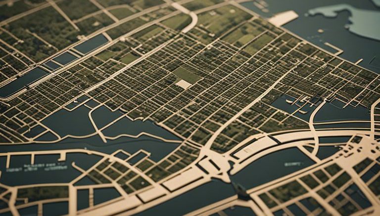
Accessing Historical Land Records
For researchers and historians, accessing historical land records is now easier than ever with ESRI’s historic maps feature. By overlaying old maps onto modern satellite imagery, users can compare and study changes in land ownership and boundaries over time.
Analyzing Patterns of Ownership Change
ESRI’s advanced geographic information systems allow users to analyze patterns of ownership change with precision. By utilizing tools like parcel data overlays and historical boundary datasets, researchers can uncover trends and shifts in land ownership that may have occurred over decades or even centuries.
To enhance the analysis of patterns of ownership change, ESRI’s software offers geospatial tools that enable users to perform complex spatial queries and generate insightful visualizations. With these capabilities, researchers can gain a deeper understanding of how land ownership has evolved in specific regions over time, shedding light on the historical context of today’s land tenure systems.
Investigating Boundary Shifts Through Time
While exploring historical maps using ESRI tools, we can uncover fascinating insights into how land boundaries have evolved over time. By overlaying maps from different eras, we can visually trace the changes in land ownership and boundary lines, shedding light on the historical context behind these shifts.
Political Implications of Boundary Changes
To understand the political implications of boundary changes throughout history, one must consider the impact on communities, governance, and territorial disputes. Shifts in borders can often be linked to power struggles, resource allocation, and diplomatic negotiations, providing valuable insights into the geopolitical landscape of the past.
Technological Tools for Boundary Analysis
One of the key advantages of using ESRI tools for boundary analysis is the ability to leverage advanced geospatial technology for accurate mapping and visualization. These tools allow researchers to compare historical maps side by side, perform spatial analyses, and create interactive presentations to showcase the evolution of boundaries over time.
Boundary analysis using ESRI tools enables researchers to conduct in-depth studies on territorial changes, investigate the factors driving boundary shifts, and gain a deeper understanding of historical events that have shaped land ownership patterns.
Applications of Historic Maps
Urban Development and Planning
To understand the evolution of urban areas, historic maps provide invaluable insights into the changes in land ownership, zoning regulations, and infrastructure development over time. By overlaying ESRI historic maps with current data, urban planners can analyze trends, identify potential areas for growth or revitalization, and make informed decisions to support sustainable urban development.
Environmental and Cultural Impact Studies
Historic maps are important tools for conducting environmental and cultural impact studies, allowing researchers to trace the historical distribution of resources, land use patterns, and cultural sites. By comparing past maps with current data, researchers can assess the impact of human activities on the environment and cultural heritage, guiding conservation efforts and sustainable development practices.
Plus, by digitizing and georeferencing historic maps, researchers can create multi-temporal datasets for spatial analysis, helping to track changes in land cover, biodiversity, and cultural landscapes over time. These studies are crucial for understanding the long-term effects of human intervention on the environment and cultural heritage, shaping policies for future conservation and preservation efforts.

Final Words
Presently, ESRI Historic Maps serve as a powerful tool for uncovering the past and exploring changes in land ownership and boundaries over time. Through the use of advanced GIS technology, researchers and historians can gain valuable insights into how our landscapes have evolved and how societies have developed. By overlaying historical maps with modern data, users can witness the transformation of territories, the establishment of new boundaries, and the shifts in property ownership. This innovative approach allows us to examine into the rich history of our surroundings and better understand the forces that have shaped our world. With ESRI Historic Maps, we can continue to piece together the puzzle of our past and appreciate the intricate tapestry of our heritage.


Be the first to comment on "Uncovering The Past With ESRI Historic Maps – Exploring Changes In Land Ownership And Boundaries Over Time"