
Software

Pictures from the Esri Startup Social 2016

First Pictures from Registration at the Esri UC 2016

Oil and Gas Space is going to the Esri UC!
Well, it’s that time of year again. The Esri User Conference is set to kick off on June 27 and last through July 1st this year…
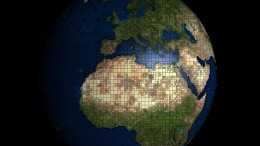
What is a GIS?
GIS allows us to view, understand, question, interpret, and visualize data in many ways that reveal relationships, patterns, and trends in the form of maps,…

The 2016 ESRI Petroleum User Group Conference
Oil and Gas Space got the chance to attend the 2016 PUG this year held in Houston, TX at the George R. Brown Convention Center…

Securing Public Data with your Server via ArcGIS Online
Navigating the world of ArcGIS Online and Portal can often be tricky. How does one balance the named users for each account while minimizing cost…
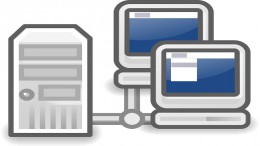
ArcGIS Server – Lessons Learned
I recently have had the experience of creating a GIS from the ground floor up and distributing and disseminating this information to various individuals inside…
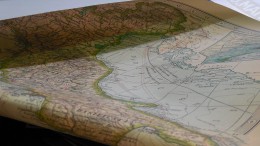
Geospatial Technology within Oil and Gas
Geospatial solution provides geospatial technologies to accurately map oil and gas infrastructures underground including oil and gas locations, gathering, distribution and production facilities. These Geospatial…

ArcGIS Online and Moving to the Cloud
Many GIS professionals are getting used to the new ArcGIS Online offered by ESRI. ArcGIS Online is a cloud based solution for data pooling and…