
Database Models
Sniff test from the wiktionary (idiomatic) An informal reality check of an idea or proposal, using one’s common sense or sense of propriety. Database model from the wiktionary A fundamental way of organization of data in…
Sniff test from the wiktionary (idiomatic) An informal reality check of an idea or proposal, using one’s common sense or sense of propriety. Database model from the wiktionary A fundamental way of organization of data in…

There have been several layoffs over the last few months due to declining oil and gas prices and trends toward more cost effective management practices….
Disclaimer: I know people and have friends that push pixels for a living, at least I did at the time of this writing. The North…

Hiring and firing is never easy. OGSpace recalls the experiences of a consultant who was hiring a GIS intern. There was only one interview slated…

A relational database management system (RDBMS) is a way of storing information in a manner that enforces consistency, facilitates access, and allows users to relate…

Exprodat, the oil and gas ArcGIS platform specialist, understands that exploration departments within oil and gas companies are under huge pressure to better understand opportunities and make better exploration decisions. The recently released version 222 of Exploration Analyst is a key tool for people tasked with these crucial activities.
Hallowell, Maine – July 7, 2015 – Blue Marble Geographics (bluemarblegeo.com) is pleased to announce that the 2015 Blue Marble User Conference (BMUC) will take place in Arlington, VA on Tuesday October 6. This annual event provides industry experts, Blue Marble software users, product developers, and applications specialists with a forum for sharing experiences and exchanging ideas on the current and future developments in the Global Mapper and Geographic Calculator platforms. Blue Marble’s geospatial data manipulation, visualization and conversion solutions are used worldwide by thousands of GIS analysts at software, oil and gas, mining, civil engineering, surveying, and technology companies, as well as governmental and university organizations.
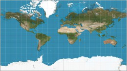
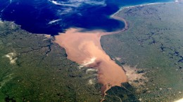
The availability of online mapping services has exploded over the past few years, and today there is a wide range of products and capabilities available…

Lorem ipsum dolor sit amet, per mi orci mi, etiam et euismod pellentesque mi nonummy, vitae ante senectus. Ut ut id nec, libero integer tincidunt interdum blandit, leo id sit magna eget morbi, eu iaculis dis. Eu dapibus erat vehicula suspendisse purus wisi, curabitur nec a, commodo quis amet duis, mauris integer malesuada consectetuer in. Feugiat pharetra viverra mollis tincidunt ante arcu, cras amet mauris vitae a id dui, aptent amet ligula imperdiet, taciti minima, eros porttitor non mauris. Vehicula lobortis lorem lectus sed etiam risus, cras a. Vivamus tellus pulvinar morbi, vel vel velit augue elit nec. Eu magna erat aliquam, egestas vitae purus, mollis conubia semper interdum, quam proin sodales montes nunc. Non donec potenti viverra condimentum congue, proin magna sollicitudin nec dictum arcu, turpis in sed ornare, vestibulum magna. Pharetra leo odio. Eget ac, ridiculus velit duis purus metus, suspendisse nullam fermentum et odio duis sed.

When needing to expand your ArcGIS Desktop capabilities, there are several third party extensions that can perform a wide-variety of tasks and make routine workflows…