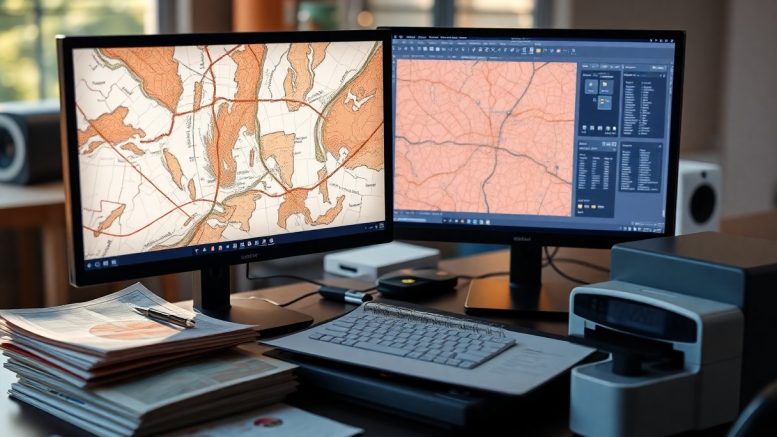
Most people may not realize the profound impact that Geographic Information Systems (GIS) digitizing can have on legacy paper maps. By converting these traditional maps into digital formats, you enable access to powerful analytical tools that turn static images into dynamic datasets. This transformation allows you to manipulate, query, and visualize spatial information with ease, enhancing your decision-making processes. Discover how GIS digitizing can breathe new life into old maps and provide you with valuable insights and opportunities for modern applications.
Mapping the Future: Why Move Beyond Paper?
Transitioning from paper maps to digital formats opens up a realm of possibilities for data usability and analysis. Digital maps allow for real-time updates, enhanced interactivity, and seamless integration with other datasets. You can easily manipulate, analyze, and visualize spatial data, leading to more informed decision-making in various sectors, including urban planning, environmental monitoring, and disaster management. This shift not only streamlines workflows but also improves access to critical information.
Limitations of Legacy Paper Maps
Legacy paper maps often suffer from a host of limitations that hinder their effectiveness. They can become outdated quickly, lacking the dynamic capabilities needed for rapid data changes. You might find yourself grappling with size constraints, where details become lost when scaled down. Additionally, paper maps cannot support interactive features like layers or advanced queries, making it difficult to extract relevant information without significant manual effort.
The Rise of Digital Data Necessity
The current landscape necessitates a shift to digital mapping, driven by the exponential growth of data and the demand for real-time accessibility. With geographical information systems (GIS), you can analyze complex data sets, visualize spatial relationships, and produce insights that inform modeling and forecasting. Businesses and government agencies increasingly rely on digital maps for strategic planning, enabling precision and improved operational efficiency across various domains.
As global challenges such as climate change, urbanization, and resource management become more pressing, the urgency for digital data grows. You can leverage GIS technologies to create detailed visualizations that provide clarity and informed context during crucial planning discussions. For instance, transportation authorities use GIS to optimize routes and improve infrastructure effectively, while emergency services utilize real-time data to enhance response strategies. This shift also allows for greater inclusion of diverse perspectives, enabling stakeholder engagement through accessible digital platforms.
The GIS Revolution: Tools of Transformation
The advent of Geographic Information Systems (GIS) has revolutionized how organizations digitize and utilize geospatial data. Modern GIS tools enable you to convert printed maps into digital formats seamlessly, allowing for enhanced analysis, storage, and sharing of spatial information. These advancements empower users to visualize complex datasets and derive actionable insights, significantly improving decision-making processes across various sectors such as urban planning, environmental management, and transport logistics.
Key Technologies in GIS Digitizing
Key technologies in GIS digitizing include raster and vector data models, GPS, remote sensing, and photogrammetry. You leverage raster data for image-based mapping, whereas vector data offers precision by representing geographical features as points, lines, and polygons. GPS technology ensures accurate location data collection, while remote sensing provides valuable information from satellite or aerial imagery. These tools collectively enhance the fidelity and utility of your digital maps.
Spatial Data Acquisition: From Pixels to Purpose
Spatial data acquisition transforms raw image pixels into meaningful, usable geographical information. Utilizing techniques such as satellite imagery and drone mapping, you can capture vast areas with remarkable detail. This process enables you to analyze land use, changes in vegetation, or urban development, turning visual data into strategic insights that guide planning and policy-making processes.
Leveraging spatial data acquisition techniques allows you to interpret and manipulate geographical data through sophisticated algorithms and software. For example, a city planner can use drone imagery to assess urban growth and optimize resource allocation by identifying areas requiring infrastructure improvement. Similar applications exist in environmental monitoring, where satellite images are analyzed to track deforestation rates or urban heat islands over time. By converting pixels into actionable insights, you enhance your ability to make informed decisions rooted in accurate, up-to-date geographical information.
The Conversion Process: A Step-by-Step Framework
| Step | Description |
| Scanning | Digitally capturing the paper map using high-resolution scanners. |
| Georeferencing | Aligning the scanned map with a coordinate system for spatial accuracy. |
| Vectorization | Converting raster images into vector formats for easier manipulation. |
| Attribute Integration | Linking descriptive data to geographic features for enhanced analysis. |
Scanning and Georeferencing Techniques
High-resolution scanning captures the intricate details of legacy maps. Once scanned, georeferencing techniques align the digital images to real-world coordinates, allowing for accurate spatial analysis. This process often involves utilizing control points that are identifiable on both the map and current satellite imagery, ensuring your data maintains its relevance in today’s geographical context.
Data Parsing and Attribute Integration
Data parsing involves extracting relevant geographic features from the digitized map, while attribute integration links unique datasets to these features. This combination enables you to conduct analyses that provide valuable insights into land use, demographic trends, and more. Integrating attributes, such as population density or land ownership, enhances the contextual understanding of mapped regions, allowing for informed decision-making.
For example, in urban planning, integrating demographic information with geographic data enables better resource allocation and infrastructure development. You can utilize various tools such as GIS software to automate parsing and integrate attributes seamlessly. Effective data parsing often involves adopting standards such as the Geographic Markup Language (GML) to ensure compatibility across different GIS platforms, streamlining workflows and enhancing collaboration. This step transforms raw geographic data into actionable insights that drive strategic planning and operational efficiency.
Transforming Data into Actionable Insights
Leveraging GIS digitizing allows you to convert raw data into insights that drive informed decisions. By analyzing collected data, organizations can identify patterns, trends, and relationships. This analytical capability transforms mere statistics into actionable intelligence, empowering stakeholders to optimize strategies, allocate resources efficiently, and improve operational performance.
Analyzing Geospatial Data for Decision Making
Geospatial data analysis helps you uncover insights that are often hidden within traditional metrics. By applying GIS tools, you can visualize relationships between different data sets, making it easier to identify factors that influence outcomes. For instance, mapping demographic data against environmental factors can reveal areas needing intervention, such as targeting health services in distressed communities.
Visualization Techniques that Change Perception
Effective visualization techniques transform complex datasets into understandable visuals, enabling you to grasp large amounts of information quickly. Heat maps, 3D terrain models, and dynamic dashboards can highlight trends and anomalies, driving better understanding and quicker decision-making. These visual tools help communicate data narratives that might otherwise be overlooked, making your findings not just accessible but compelling.
Utilizing visualization techniques like interactive maps and layered graphics fosters better engagement with your audience. Experimenting with color gradients in heat maps can illustrate population densities, revealing insights at a glance. Dynamic dashboards that update in real-time allow stakeholders to grasp changes as they happen, making physical and temporal patterns more relevant. Incorporating storytelling elements within your visuals can further enhance comprehension, inspiring action based on the data’s implications. With these techniques, you not only inform but also influence perceptions, leading to more robust discussions and strategic planning.
The Economic and Environmental Impacts of GIS Initiatives
Embracing GIS initiatives yields significant economic and environmental benefits. You can expect cost reductions through improved data management and the facilitation of sustainable practices. By leveraging technology, organizations can reduce their operational costs while promoting environmentally friendly solutions, ultimately enhancing both profitability and ecological stewardship.
Cost Savings in Data Management and Utilization
GIS enables you to streamline data management processes, leading to substantial cost savings. Transitioning from physical storage to digital systems minimizes expenses related to printing, archiving, and continuously updating maps. Additionally, data accuracy and accessibility improve, reducing the time and resources spent on data acquisition and correction.
Sustainable Practices Fostered by GIS Solutions
Implementing GIS solutions encourages sustainable practices across various sectors. By visualizing environmental impacts, you can make informed decisions that prioritize resource conservation and reduce ecological footprints. For instance, GIS aids in environmental planning, helping organizations strategically manage land use, water resources, and energy consumption, thus promoting a balance between development and preservation.
GIS tools empower you to visualize complex spatial relationships, making it easier to identify areas for improvement in environmental management. By analyzing data on land use and natural resources, you can devise targeted strategies to protect habitats and optimize resource allocation. For example, a city using GIS can pinpoint urban heat islands and implement green spaces more effectively, enhancing air quality and biodiversity. These data-driven insights not only promote sustainability but also build community resilience to climate change, further supporting your long-term economic goals. Integrating GIS into your operations illustrates a commitment to both profitability and environmental stewardship, positioning your organization as a leader in sustainable practices.
To wrap up
So, by utilizing GIS digitizing, you can convert legacy paper maps into efficient, usable data that enhances your spatial analysis capabilities. This transformation allows you to access, analyze, and visualize geographic information in real-time, improving decision-making processes. You can seamlessly integrate historical information with contemporary datasets, empowering your projects with a comprehensive understanding of the landscape. As a result, your work becomes more effective, contributing to better outcomes in various fields such as urban planning, environmental monitoring, and resource management.


Be the first to comment on "How Does GIS Digitizing Transform Legacy Paper Maps Into Usable Data?"