There’s a transformative advantage for businesses that digitize hard copy maps into Geographic Information Systems (GIS). By integrating these traditional maps into digital platforms, you can enhance data accuracy, streamline operations, and improve decision-making processes. Your access to real-time analytics and spatial data empowers you to visualize trends and patterns that would otherwise remain hidden. Ultimately, this shift not only optimizes resource management but also drives greater efficiency in your business strategies.
Transforming Physical Maps: The Digital Shift
Transitioning from hard copy maps to digital formats offers businesses streamlined access to critical geographic information. This digital shift not only enhances data accuracy but also allows for more efficient data management and analysis. You can effectively leverage digital mapping for real-time updates, significantly improving decision-making processes and operational efficiency in various sectors, such as urban planning, logistics, and environmental management.
The Technical Process of Digitization
The digitization of physical maps involves scanning, georeferencing, and vectorization. First, high-resolution scanners capture detailed images of the maps, creating digital files. Next, georeferencing aligns these images with real-world coordinates, ensuring spatial accuracy. Finally, vectorization transforms raster images into editable vector formats, which allows for easier manipulation and integration into GIS systems.
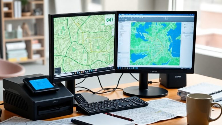
Key Technologies Facilitating Transformation
Several key technologies empower the conversion of physical maps to digital formats. Geographic Information System (GIS) software enables the integration of spatial data with analytical capabilities. Scanning technologies, such as high-resolution flatbed and handheld scanners, capture intricate details. In addition, Optical Character Recognition (OCR) software extracts textual data from scanned maps, enhancing usability and searchability.
GIS software, like ArcGIS or QGIS, allows you to visualize and analyze spatial relationships effectively. High-resolution scanners ensure that every detail from the original map is preserved. OCR technology adds another layer of efficiency by enabling the search and extraction of relevant information from the scanned images. By combining these technologies, you optimize workflows, improve accuracy, and gain deeper insights into your geographic data, making impactful decisions based on comprehensive analyses. This comprehensive approach not only preserves the historical value of the maps but also enhances their functionality in a modern digital context.
Unlocking Data Insights: Analyzing Geographic Information
Through digitization, you gain access to powerful tools that enable in-depth geographic data analysis. Geographic Information Systems (GIS) allow for the processing and visualization of spatial data, helping businesses spot patterns, understand trends, and make data-driven decisions. With enhanced capabilities to layer multiple datasets, you can uncover hidden correlations that were previously difficult to identify, driving more effective strategies in various operational areas.
The Power of Spatial Analysis
Spatial analysis empowers you to examine data based on location, revealing insights that are geographically relevant. Tools within GIS let you perform various analyses, such as proximity assessments, clustering, and site suitability evaluations. This helps you identify optimal locations for new stores or pinpoint areas requiring resource allocation, enhancing overall efficiency.
Enhanced Decision-Making Capabilities
With digitized maps integrated into your decision-making process, you can visualize complex data and assess scenarios that impact your business outcomes. The ability to geo-reference information provides context, making it easier for you to weigh options and predict future trends convincingly. By using GIS to simulate different scenarios, you fine-tune your strategies effectively, leading to more informed and timely decisions.
Leveraging GIS for decision-making transforms the way you approach challenges in your business. For instance, retail chains can analyze foot traffic and competitor locations to determine where to open new outlets. In real estate, evaluating market trends and property values through spatial data enables you to target investments strategically. Such informed decisions based on robust geographic insights can significantly enhance profitability and operational efficiency, ultimately providing a competitive edge in your market.
Streamlining Operations: Efficiency Gains Through GIS
Implementing GIS technology significantly enhances operational efficiency by providing a centralized platform for data management and analysis. Your team can access and analyze geographical data in real-time, leading to quicker decision-making processes. As a result, you reduce redundancies, optimize routes, and improve project timelines, ultimately saving time and resources.
Improved Resource Management
With GIS, you achieve better resource allocation by accurately mapping assets and identifying areas of need. Detailed spatial analysis allows you to visualize resource distribution, enabling you to deploy your assets more effectively and minimize waste. As an outcome, you enhance productivity and reduce operational costs.
Automating Routine Processes
Routine tasks become significantly streamlined through GIS automation features, allowing you to focus on higher-value activities. Manual data entry and analysis can be replaced by automated workflows that update information in real time, reducing human error and improving data integrity. This automation also fosters better communication among teams, as everyone accesses the latest information without delays.
By integrating GIS into daily operations, you can automate processes like data collection, reporting, and task assignments. For example, field teams can use mobile GIS applications to capture and upload data directly to the central system, eliminating the need for later data entry. This also supports automatic alert systems for maintenance schedules or resource allocation, further enhancing operational efficiency. Automation translates to quicker response times, allowing your business to adapt and grow in a competitive landscape, securing your position as a leader in your industry.
Enhancing Customer Engagement: Mapping for User Experience
Digitizing maps allows you to create interactive experiences that engage customers effectively. By integrating geographic data with user interfaces, you can offer clients dynamic visualizations that respond to their queries, improving their understanding and interactions with your service. The ability to toggle layers, zoom into specific areas, and access real-time data empowers customers, making their experience more enjoyable and informative.
Visualizing Data for Better Communication
Visualization transforms complex data into clear insights, making it easier for you to communicate effectively with clients. By presenting geographic information through interactive maps, you encapsulate trends, patterns, and critical statistics in a visually compelling manner. This enhances customer comprehension, leading to informed decision-making and deeper engagement with your brand.
Tailoring Services to Customer Needs
Personalized interactions are facilitated through GIS by enabling you to analyze customer behaviors and preferences based on location data. This targeted approach allows you to customize services and marketing strategies directly aligned with specific customer segments, leading to increased satisfaction and loyalty.
For instance, a retail chain can analyze foot traffic patterns to offer personalized promotions based on nearby customers. By identifying high-traffic areas and demographics, you can tailor your marketing efforts to reach those most likely to engage, enhancing customer satisfaction and increasing sales. Additionally, leveraging geospatial data helps you anticipate trends and adapt services accordingly, ensuring your offerings meet evolving customer expectations effectively.
Strategic Advantages: Navigating the Competitive Landscape
Digitizing hard copy maps into GIS offers you a significant strategic advantage by providing deeper insights into market trends and competitive positioning. This enhanced spatial awareness enables informed decision-making that drives business growth. It allows for a comprehensive analysis of location-based strategies, which can pinpoint opportunities for optimization, efficiency, and innovation that your competitors may overlook.
Leveraging Geographic Intelligence for Business Strategies
Your ability to leverage geographic intelligence can refine your business strategies dramatically. Accurate mapping of customer behaviors and preferences fosters targeted marketing and resource allocation, ensuring you maximize your impact. Integrating geographic data into your business strategies allows for precise adjustments based on demographics, consumer trends, and competitive landscapes, helping you stay relevant and effective.
Staying Ahead with Predictive Analytics
Predictive analytics transforms your geographic data into forward-looking insights, allowing you to anticipate market changes and consumer behavior. Utilizing trends and forecasting models enhances your strategic planning, so you can adapt quickly to evolving conditions and seize new opportunities before your competitors do.
Using predictive analytics in conjunction with GIS enables nuanced spatial forecasting. For example, businesses can analyze historical purchase patterns geographically to predict future sales trends in specific areas. This data-driven foresight allows you to strategically allocate resources, optimize inventory levels, and enhance customer engagement initiatives based on anticipated demands. By employing such analytics, you position your business to respond proactively to market shifts, ensuring sustained growth and competitive advantage.
To wrap up
Summing up, digitizing hard copy maps into GIS allows you to enhance the accuracy and accessibility of your spatial data, facilitating better decision-making and resource management for your business. This modernization streamlines operations and improves collaboration by allowing you to share information seamlessly among teams. Furthermore, it empowers you to analyze data in real-time, helping you respond swiftly to changes in your environment. Ultimately, integrating GIS into your workflows positions your business for greater efficiency and informed strategic planning.


Be the first to comment on "How Do Businesses Benefit From Digitizing Hard Copy Maps Into GIS?"