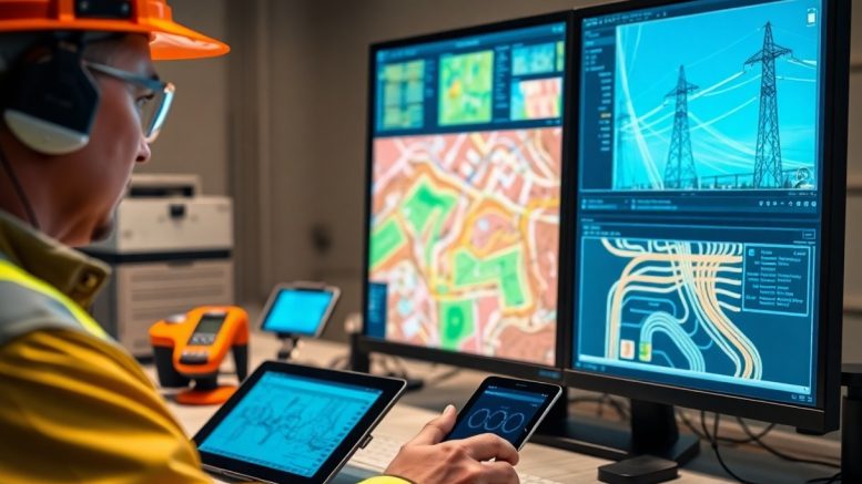
GIS technology plays a pivotal role in enhancing the operational efficiency of utilities and infrastructure. By digitizing your assets, you gain access to valuable spatial data that allows for better management, planning, and decision-making. This technology enables you to visualize your systems in real-time, streamline processes, and improve service delivery. As you explore the benefits of GIS digitizing, you will discover how it can ultimately lead to cost savings and increased productivity in your organization.
The Transformative Power of GIS Digitizing
Harnessing GIS digitizing fundamentally alters how utilities and infrastructure operate. You gain the ability to visualize spatial data, identify patterns, and enhance overall efficiency. By integrating geospatial information, organizations streamline maintenance, improve service delivery, and optimize resource allocation. Ultimately, this transformative power leads to more sustainable practices and cost savings.
Revolutionizing Data Accessibility
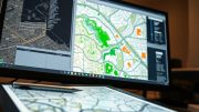
With GIS digitizing, you experience a dramatic shift in data accessibility. All stakeholders can easily access high-quality, real-time spatial data, allowing for seamless collaboration across departments. The risk of errors diminishes and informed decisions can be made swiftly. This accessibility empowers teams to respond effectively to changing conditions and demands.
Enhancing Real-Time Decision Making
Real-time decision making becomes significantly more efficient through GIS digitizing. You can monitor utility systems, such as water and electricity, continuously. This allows for immediate identification of issues, reducing response times and minimizing service interruptions. The integration of IoT devices with GIS further amplifies this capability, offering live updates and analytics tailored to your specific needs.
For example, a city that implemented GIS with real-time monitoring of its water distribution network saw a 30% reduction in leakage rates within the first year. By visualizing live data on a digital map, operators swiftly pinpointed problem areas and dispatched repair crews immediately. This not only improved service reliability but also saved significant operational costs, showcasing the impactful role of GIS in driving efficiency in decision-making processes.
Cost Efficiency Unlocked: The Financial Impacts of GIS
GIS not only enhances operational workflows but also significantly reduces costs for utilities and infrastructure. By providing real-time data and spatial insights, you can minimize expenses related to project planning, execution, and maintenance. The adoption of GIS results in improved decision-making processes, leading to lower overheads and increased profitability. Studies show that organizations integrating GIS can achieve operational cost savings upwards of 30%, highlighting its critical role in financial efficiency.
Reducing Operational Costs through Precision
Precision in data collection and analysis via GIS allows you to pinpoint inefficiencies and resource wastage. By leveraging accurate geographic information, your teams make informed decisions, from optimizing resource distribution to accurately predicting maintenance needs. This targeted approach leads to less redundant spending, enabling you to allocate funds more strategically.
Streamlining Maintenance and Resource Allocation
GIS facilitates an organized and systematic approach to maintenance by visually mapping infrastructure and utilities. This enables you to prioritize tasks based on urgency and importance, significantly enhancing resource allocation. Accurate data helps in identifying areas requiring immediate attention while ensuring that routine tasks are managed effectively, resulting in reduced downtime and better service delivery.
The integration of GIS means your maintenance teams can access detailed asset information instantly. For instance, a water utility using GIS mapping improved response times to leaks by 40%, enhancing customer satisfaction while drastically reducing workforce hours on-site. With real-time data at your fingertips, you’re equipped to streamline scheduling, coordinate materials more efficiently, and eliminate unnecessary trips, translating to substantial cost savings across the board.
Risk Mitigation: How GIS Protects Utilities and Infrastructure
GIS technology significantly enhances risk mitigation strategies for utilities and infrastructure. By offering precise spatial analysis, you can identify potential hazards and vulnerabilities within your network. This informed approach enables proactive measures to protect critical assets, ensuring greater resilience against natural disasters, cyber threats, and operational disruptions that may arise in your service area.
Anticipating and Managing Disruptions
Utilizing GIS allows you to anticipate disruptions by analyzing patterns and historical data related to outages and service interruptions. With real-time monitoring, your team can pinpoint high-risk areas and address maintenance proactively, reducing the probability of unexpected failures and minimizing restoration times for affected customers.
Strengthening Emergency Response Strategies
GIS enhances emergency response strategies by providing detailed, real-time maps and data during crises. Your teams can visualize affected areas, assess damage, and allocate resources efficiently, ensuring a quicker recovery process. This technology streamlines communication across departments and agencies, making coordination during emergencies significantly more effective.
In practical terms, during an emergency response, GIS enables your teams to overlay infrastructure data with live incident reports. You can quickly pinpoint the most severely impacted areas, prioritize intervention efforts, and even simulate various response scenarios to enhance decision-making. For example, during Hurricane Sandy, utilities equipped with advanced GIS platforms reported faster recovery times by effectively managing workforce deployment and logistical challenges. Investing in GIS not only aids immediate responses but also transforms your ongoing readiness for future emergencies.
Integrating GIS with Smart Technologies for Future Readiness
Integrating GIS with smart technologies positions your utilities and infrastructure for future challenges. By leveraging real-time data from connected devices, you can enhance decision-making, streamline operations, and foster greater collaboration across systems. This synergy helps you create more resilient and adaptive networks that respond dynamically to changing environments and consumer demands.
The Role of IoT in GIS Applications
The Internet of Things (IoT) enhances GIS applications by providing a continuous flow of real-time data from various sensors and devices. You can use this information to monitor infrastructure conditions, track utility usage, and predict maintenance needs, enabling proactive management and reducing downtime.
Shaping Sustainable Urban Planning with Geospatial Data
Geospatial data plays a transformative role in sustainable urban planning by offering precise insights into land use, demographics, and environmental factors. You can harness this data to guide development, optimize resource allocation, and ensure that urban growth aligns with sustainability goals.
As urban landscapes evolve, the integration of geospatial data allows you to anticipate challenges like congestion, pollution, and resource scarcity. By analyzing spatial patterns and trends, you can devise informed strategies for green spaces, transportation systems, and utilities, ultimately designing cities that balance growth with ecological responsibility. This data-driven approach ensures that urban planning not only meets current needs but also fosters a sustainable environment for future generations.
The Human Element: Training and Skills Development in GIS
Investing in training and skills development for GIS is necessary for maximizing its benefits across utilities and infrastructure sectors. By equipping your team with the necessary knowledge and skills, you foster a workforce that can effectively leverage GIS tools for analysis, decision-making, and operational efficiency. Engaging training programs tailored to specific roles ensure that employees can seamlessly integrate GIS into their daily tasks, ultimately enhancing productivity and service delivery.
Bridging the Skills Gap for Utility Workers
Utility workers often face a significant knowledge gap when it comes to utilizing GIS technology effectively. Providing targeted training programs that address this gap enables your workforce to harness the full potential of GIS, offering practical applications in fieldwork, asset management, and emergency response. By developing GIS competency among your staff, you can ensure that they are equipped to manage infrastructure more efficiently and respond proactively to challenges.
Fostering a Culture of Continuous Improvement
Embedding a culture of continuous improvement within your organization is vital for maximizing GIS capabilities. Encouraging ongoing learning and adaptation helps your team stay ahead of technological advancements and best practices. Establish regular training updates and workshops that allow your employees to explore new features and methodologies within GIS. Additionally, implementing feedback mechanisms can help refine processes and enhance data accuracy, ensuring your organization remains resilient and innovative in an evolving landscape.
Emphasizing continuous improvement creates an environment where your team is motivated to explore GIS’s evolving capabilities. For example, organizing monthly innovation sessions allows employees to share insights and experiment with new tools, thus encouraging creative problem-solving. By tracking performance metrics and celebrating successes, your team fosters a collective commitment to enhancing operational efficiencies and service quality. This proactive approach not only strengthens employee engagement but also leads to better decision-making across the organization, ultimately benefiting the communities you serve.
To wrap up
Conclusively, understanding the value of GIS digitizing for utilities and infrastructure empowers you to enhance operational efficiency, improve decision-making, and optimize resource allocation. By integrating GIS technology into your processes, you can achieve accurate mapping, real-time data analysis, and streamlined communication. This not only fosters better management of assets but also supports sustainable practices and proactive maintenance strategies, ultimately leading to improved service delivery and cost savings. Embracing GIS digitizing is an investment in your organization’s future success and resilience.


Be the first to comment on "What’s The Value Of GIS Digitizing For Utilities And Infrastructure?"